
找一套按发生位置和过火面积整理好的山火数据,例如:
Mouillot, F. and Field, C.B. (2005), Fire history and the global carbon budget: a 1°× 1° fire history reconstruction for the 20th century. Global Change Biology, 11: 398-420. https://doi.org/10.1111/j.1365-2486.2005.00920.x
写个简单的程序,按山火数据给出发生位置的方式将地图划分为若干格,按过火面积设定不同的颜色,让程序逐格检测给定格子对应的过火面积的值、按设定的颜色给格子上色。
亦可使用现有程序(例如 https://www.esri.com/en-us/home )的功能。
这是别人上色的成果[1]:
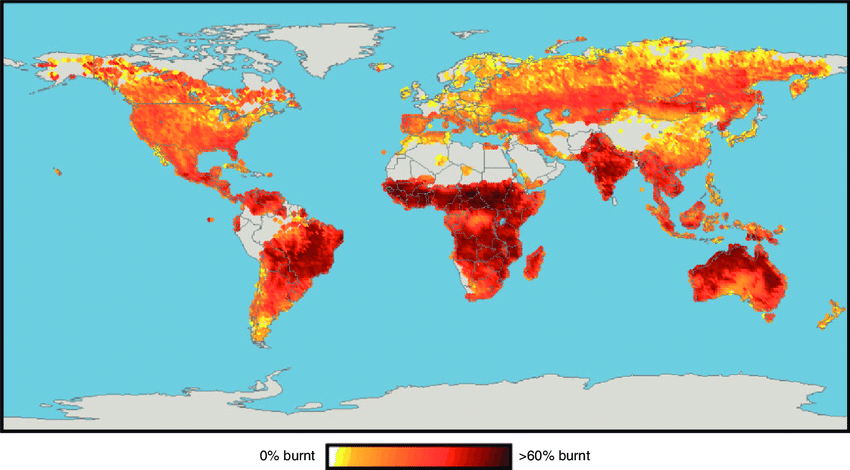
如果觉得程序上色缺乏仪式感、格子数量也没多到人工不能完成的程度,那么你可以按照数据在图片处理软件里手动给格子上色。这是 A4 雕花(物理),信息时代的手工业。
参考
- ^Flannigan, Mike & Krawchuk, Meg & Wotton, Mike & Johnston, Lynn. (2009). Implications of changing climate for global Wildland fire. International Journal of Wildland Fire. 18. 483-507. 10.1071/WF08187.
编辑于 2022-12-05 01:00・IP 属地辽宁